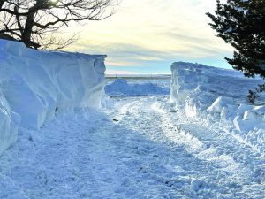
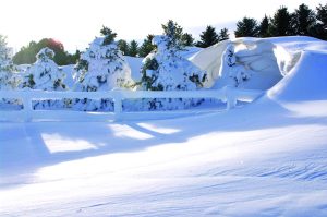
Governor Pete Ricketts issued an Emergency Proclamation for counties in the Panhandle and north central Nebraska that were slammed during last week’s winter storm.
Ricketts described the impact of the storm as a threat to critical services.
“Nebraskans in the Panhandle and North Central Nebraska have been dealing with strong winter storm conditions since Tuesday. It’s threatened to cut off our rural hospital patients, health care workers, and anyone experiencing an emergency in these areas,” said Ricketts. “This emergency proclamation will aid them in their efforts as they work to keep their communities safe.”
Snow began falling across the Panhandle on Dec. 13 and continued through Thursday in some parts of the region.
Michael Charnick, Meteorologist with the National Weather Service in Cheyenne explained that Alliance received approximately one foot of snow, though he noted accurate measurements were difficult to obtain.
“One caveat with all this is there was a lot of wind with this event,” said Charnick. “So, in many places the ground could have been blown bare in some spots, and we had reports of six to seven foot high drifts in some places like on the sides of buildings and off of some terrain features.”
Charnick noted Chadron received higher amounts of snow because of the way the system lingered in the region. He said between 12 and 24 inches of snow fell in the Chadron area.
“They were under a really strong band of moderate to heavy snowfall for a long time,” Charnick said. “There were several waves that came through. The drifting up there was pretty bad as well. Anywhere along that 385 corridor was in that 12 to 24 inch range with drifts as high as six to seven feet.”
Charnick said that no snowfall total was available for Hemingford. He noted the amount of snow Scottsbluff received was similar to Alliance.
“It was definitely our first big snow event of the year, and with all of the cold air that’s around, the snow really hasn’t melted much at all, and is going to be sticking around for quite some time,” said Charnick. “There’s definitely going to be a lot of long-lasting piles of snow out of that.”
More snow is in the forecast for Wednesday, though, Charnick explained, the storm is expected to only drop one to two inches.
Charnick warned that a cold front is moving into the region this week, bringing with it dangerous wind chills and temperatures that will drop quickly.
“That’s going to be the main story going forward is this really strong cold front coming through Wednesday afternoon,” Charnick said. “Early in the day it’s going to be fairly mild, but it will be quickly dropping behind the front as it comes through in the afternoon. Temperatures could drop 30 degrees in an hour as it comes through.
“The wind chills are going to be an even bigger factor than the air temperature,” said Charnick. “The winds are going to be blowing 30 to 40 miles per hour, so with that cold air, it really presents a dangerous situation. Wind chill values in the Nebraska Panhandle are going to be in the minus 40s to the minus 50s in some places, even some minus 60s are possible during the periods of strongest wind. That’s one of the more dangerous situations you can experience in winter, even arguably more dangerous than heavy snow because if you’re outside and you’re not prepared, that could be a very dangerous situation.”
Charnick encouraged people to take caution with the cold front, urging people to stay inside and only travel when needed. He encouraged those who must venture outside to dress in layers. He encouraged people with pets or livestock that may not be used to the cold to give them shelter from the frigid air.


(Photos Courtesy of Becky Potmesil)

